

General Info:
A receiver is mounted to something stationary and position data is recorded, one point per second, for 24 hours. The resulting data is processed and plotted to determine how much position drift the receiver thinks it saw.
- All RTK tests are processed with a correction data age limit of 10 seconds. Points with older correction data are discarded.
- If you want to do your own data analysis, the NMEA GGA data files are available for download at the bottom of each page.
March 2015 Tests: TerraStar-D and TerraStar-C
TerraStar-D vs TerraStar-C
| Data Source | Date | Notes |
| TerraStar-D | 2015-03-14 | - |
| TerraStar-D | 2015-03-15 | - |
| TerraStar-C | 2015-03-17 | High geo-magnetic activity |
| TerraStar-C | 2015-03-18 | - |
| TerraStar-C | 2015-03-19 | - |
Details: A NovAtel Smart6-L was used for this test. Firmware version 6.510 was used for testing TS-D and version 6.600 was used for testing TS-C. Static accuracy, both over the entire 24 hours and in 15 minute increments appear to be very similar for TS-D and TS-C. TS-C is advertised to have much faster re-convergence in the event of a short term signal loss, which was not tested in this test. There was a substantial amount of geo-magnetic activity during the first TS-C data capture, but it doesn't seem to have affected the performance.
Winter 2010-2011 Tests:

Details:
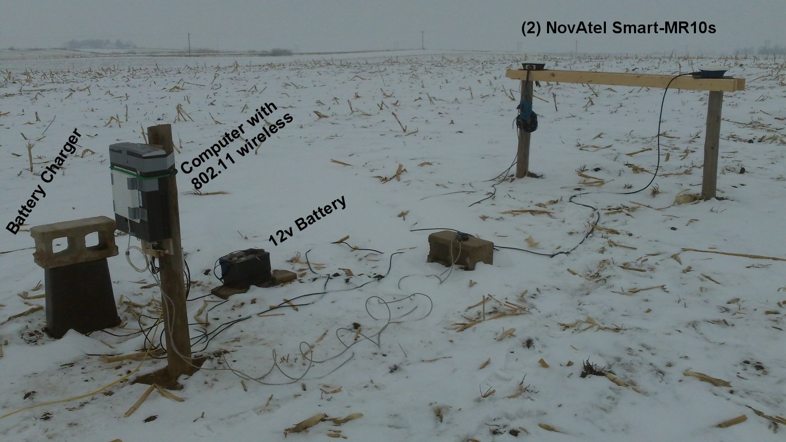
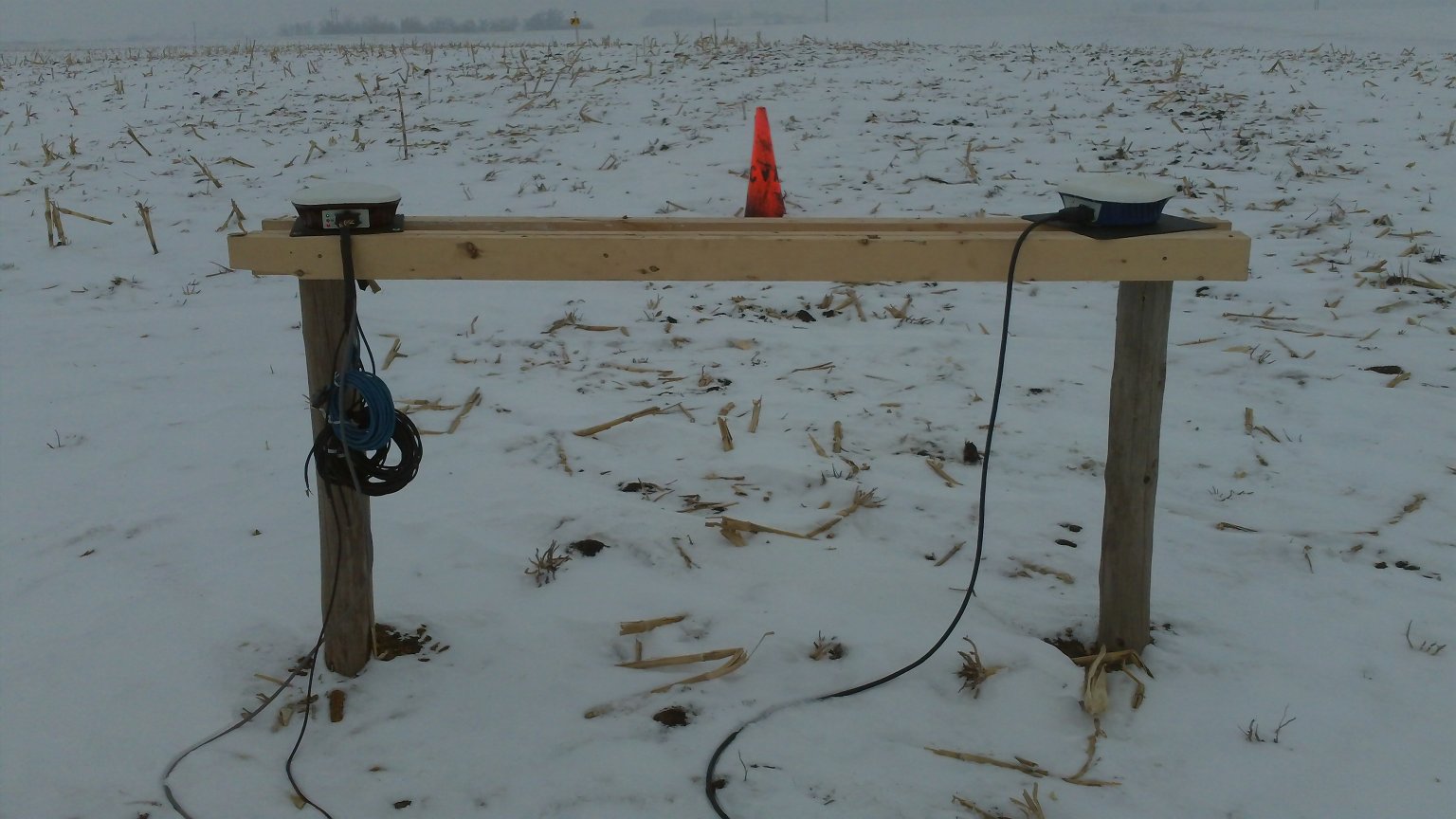
Location: 41.9807, -91.7907 (West of Cedar Rapids, IA)
Ground conditions: disked corn stalks (rough dirt) with snow cover.
Sky visibility: 255 meters above sea level, highest point within 1/4 mile, nearest building/trees was ~400 feet away and was less than 5 degrees above the horizon.
GPS receivers used: Two Novatel Smart MR-10 pre-production receivers unlocked for RTK+GLONASS, firmware v3.800
Observations:
Autonomous, WAAS, GLIDE: Those of us in North America usually use WAAS for the tillage and other operations where free is good. However, there are parts of the world (think South America) where there isn’t a free DGPS/SBAS correction signal. For those places, the engineers at NovAtel have developed something they call GL1DE to reduce the pass-to-pass position drift when running autonomously. Think of it as a smoothing algorithm, although there is a lot more to it than that. What I found was that a receiver running autonomously with GL1DE has a similar level of accuracy to a receiver running on WAAS without GL1DE. However, if you turn on both WAAS and GL1DE, the pass-to-pass drift is approximately half of what you would see on just WAAS. In other words, if you are using a NovAtel receiver on WAAS, turn on GLIDE too.
OmniStar XP and XP G2: OmniStar XP and HP have been around a while and are GPS only signals. OmniStar now offers a GPS+GLONASS signal called XP G2 (I’ll just call it G2 to avoid some confusion). The price is the same as XP. G2 does have a bit better long term accuracy (I'm talking 24 hour blocks) than XP. G2 does not show any improvement in pass-to-pass accuracy over XP. The main attraction to G2 is that adding GLONASS to the system increases the number of satellites available, which will help when working in areas where trees or building block some satellites from view. A receiver on XP will track 6 to 12 sats, with the average at 9.24. A receiver on G2 will track 11 to 21 sats, with the average at 15.5.
Convergence time is the one thing that people seem to dislike about a receiver running on OmniStar. The length of time is related to the number of visible satellites. Thus a receiver will converge faster when there are 12 satellites visible than when there are only 6 visible. Following that pattern, G2 converges faster than XP because of the additional satellite visibility. It doesn’t eliminate the convergence time, but it is about 30% faster than XP.
RTK: The IA DOT’s RTN provides RTK correction data in three models:
-Near (the single nearest base station)
-IMAX (network modeled correction data that appears to come from one base)
-MAX (network modeled correction where the data from several bases goes to the rover, and the rover does the math).
First of all, the IMAX solution is useless. Don’t use it, ever. Not only is the accuracy worse than using a single base station, it also reduces the number of usable satellites. On a receiver that only uses the GPS satellites, this can be a big problem during parts of the day when there are only 6 GPS sats above the horizon. If two of them are unusable because they aren’t high enough to be seen by all the base stations, then you will drop below the minimum threshold and lose your RTK fix.
MAX does produce slightly better accuracy than the nearest single base station, but it isn’t huge. A base station in the same field will still produce better results than a MAX network correction with a 10 mile base line.
Long baselines: I tried pulling correction data from a base on the IA RTN that was 58 miles away. The receiver went to DGPS, but wouldn’t get to RTK. Using a different base at 40 miles, I was able to get RTK fix. The accuracy of a base at 39 miles is similar to that of running on OmniStar XP.
How stable is GPS+Glonass RTK with a very short baseline?
| Data Source | Solution | Baseline Distance | Data Type | Test 1 | Test 2 | Test 3 |
| Local MR10 | Single base | 6 feet | RTCM v3 | 2010-12-18 | 2010-12-19 | 2010-12-20 |
IA DOT RTN - RTCMv3 IMAX vs MAX
| Data Source | Solution | Baseline Distance | Data Type | Test 1 | Test 2 | Test 3 |
| IA DOT RTN | IMAX | Network | RTCM v3 | 2010-12-22 | 2010-12-23 | 2010-12-24 |
| IA DOT RTN | MAX | Network | RTCM v3 | 2010-12-22 | 2010-12-23 | 2010-12-24 |
IA DOT RTN - RTCMv3 NEAR vs MAX
| Data Source | Solution | Baseline Distance | Data Type | Test 1 | Test 2 | Test 3 |
| IA DOT RTN | Nearest base | 9.26 miles | RTCM v3 | 2010-12-26 | 2010-12-27 | 2010-12-29 |
| IA DOT RTN | MAX | Network | RTCM v3 | 2010-12-26 | 2010-12-27 | 2010-12-29 |
IA DOT RTN - CMR+ NEAR vs IMAX
| Data Source | Solution | Baseline Distance | Data Type | Test 1 | Test 2 | Test 3 |
| IA DOT RTN | Nearest base | 9.26 miles | CMR+ | 2010-12-31 | 2011-01-01 | 2011-01-02 |
| IA DOT RTN | IMAX | Network | CMR+ | 2010-12-31 | 2011-01-01 | 2011-01-02 |
IA DOT RTN - CMR+ NEAR vs RTCMv3 NEAR
| Data Source | Solution | Baseline Distance | Data Type | Test 1 | Test 2 | Test 3 |
| IA DOT RTN | Nearest base | 9.26 miles | CMR+ | 2011-01-04 | 2011-01-05 | 2011-01-06 |
| IA DOT RTN | Nearest base | 9.26 miles | RTCM v3 | 2011-01-04 | 2011-01-05 | 2011-01-06 |
Longer baseline distance on GPS only - Friend's base at 31.9 miles vs. IA DOT RTN at 9.26 miles.
| Data Source | Solution | Baseline Distance | Data Type | Test 1 | Test 2 | Test 3 |
| Friend's farm | Single base | 31.9 miles | CMR+ | 2011-01-10 | 2011-01-11 | 2011-01-13 |
| IA DOT RTN | Nearest base | 9.26 miles | CMR+ | 2011-01-10 | 2011-01-11 | 2011-01-13 |
Longer baseline distance - IA DOT RTN (Tama) at 39.08 miles vs. IA DOT RTN (Newhall) at 9.26 miles.
| Data Source | Solution | Baseline Distance | Data Type | Test 1 | Test 2 | Test 3 |
| IA DOT RTN: Tama | Single base | 39.08 miles | RTCM v3 | 2011-01-15 | 2011-01-16 | 2011-01-17 |
| IA DOT RTN: Newhall | Single base | 9.26 miles | RTCM v3 | 2011-01-15 | 2011-01-16 | 2011-01-17 |
WAAS with and without GLIDE, in static mode
| Data Source | Test 1 | Test 2 | Test 3 |
| WAAS | 2011-01-19 | 2011-01-20 | 2011-01-21 |
| WAAS with Glide | 2011-01-19 | 2011-01-20 | 2011-01-21 |
WAAS with and without GLIDE, in dynamic mode
| Data Source | Test 1 | Test 2 | Test 3 |
| WAAS | 2011-01-23 | 2011-01-24 | 2011-01-25 |
| WAAS with Glide | 2011-01-23 | 2011-01-24 | 2011-01-25 |
Autonomous with dynamic GLIDE compared to WAAS with dynamic GLIDE
| Data Source | Test 1 | Test 2 | Test 3 |
| Autonomous with GLIDE | 2011-01-27 | 2011-01-28 | 2011-01-29 |
| WAAS with Glide | 2011-01-27 | 2011-01-28 | 2011-01-29 |
OmniStar XP vs XP G2
| Data Source | Test 1 | Test 2 | Test 3 |
| XP (GPS only) | 2011-02-17 | 2011-02-18 | 2011-02-19 |
| XP G2 (GPS + Glonass) | 2011-02-17 | 2011-02-18 | 2011-02-19 |
Winter 2009-2010 Tests:

Location: 41.8958, -91.7707 (SW of Cedar Rapids, IA)
Ground Conditions: Chisel plowed corn stalks (rough dirt) with snow cover for the early tests.
Sky Visibility: 255 Meters above sea level, highest point within 1/4 mile, nearest building was ~200 feet away and was less than 5 degrees above the horizon.
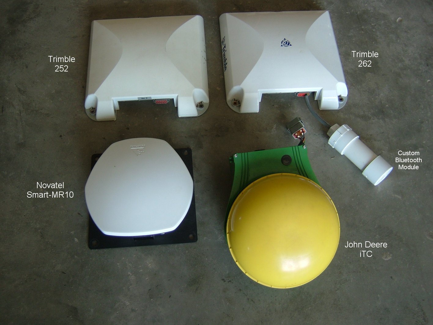
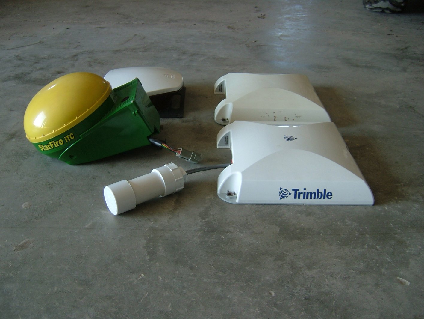
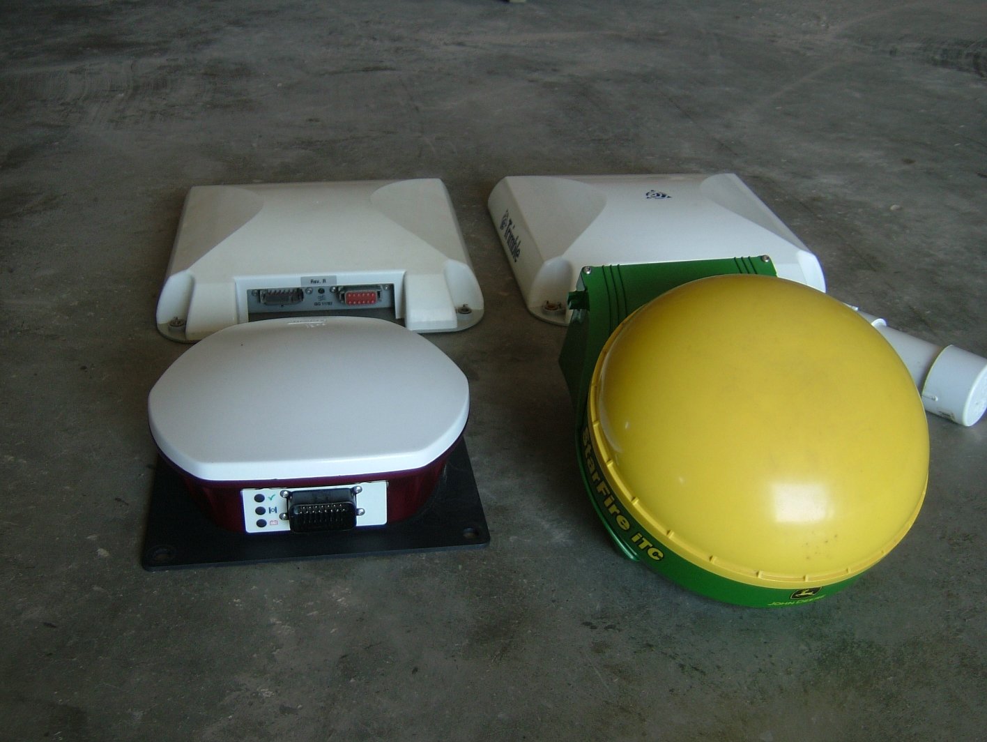
GPS receivers used:
- John Deere iTC on SF1, tilt comp disabled, firmware v3.41A for the first SF1 test, v3.60D for the second SF1 test
- John Deere iTC on SF2, tilt comp disabled, firmware v3.60D
- Trimble 252 unlocked for OmniStar, firmware v3.70
- Trimble 262 unlocked for RTK, firmware v2.00
- Novatel Smart MR-10 pre-production unit unlocked for RTK+Glonass
WAAS vs John Deere SF1
20100113-jditc-sf1
20100113-novatelmr10-waas (GL1DE filter enabled)
20100113-trimble252-waas
20100113-trimble262-waas
IA DOT RTN CMR+ Nearest Base Station (11.2 miles from nearest base)
20100306-novatelmr10-rtk-cmrpnear
20100306-trimble262-rtk-cmrpnear
20100307-novatelmr10-rtk-cmrpnear
20100307-trimble262-rtk-cmrpnear
IA DOT RTN CMR+ IMAX Network Solution (11.2 miles from nearest base)
20100309-novatelmr10-rtk-cmrpimax
20100309-trimble262-rtk-cmrpimax
20100310-novatelmr10-rtk-cmrpimax
20100310-trimble262-rtk-cmrpimax
20100311-novatelmr10-rtk-cmrpimax
20100311-trimble262-rtk-cmrpimax
OmniStar XP vs John Deere SF2
20100314-jditc-sf2
20100314-trimble252-xp
20100314-trimble262-xp
20100315-jditc-sf2
20100315-trimble252-xp
20100315-trimble262-xp
More John Deere SF1 (captured more data because the first SF1 test looks a lot like SF2)
20100319-jditc-sf1
20100321-jditc-sf1
20100322-jditc-sf1
Observations:
John Deere SF1 and SF2 look extremely similar in the horizontal axis, however, they do have slightly different characteristics in the vertical axis, with SF2 being more stable. The vertical data is mostly irrelevant because the people who do care about elevation data are going to be on RTK anyway.
I noticed that two of the data captures from the Deere receivers that had bad data - those events occurred on Friday nights. Not sure if that is a maintenance thing or just coincidence.
The IA DOT RTN has an IMAX network correction option which is supposed to improve accuracy at long baselines. I saw better data from single base station 11.2 miles away than I did from the network correction. Plus, the IMAX solution reduces your available satellites by an average of 1.3-2.0, which can cause you to drop RTK fix during some parts of the day.
The above data doesn't show this, but I played with the IA RTN using fake position data from various distances away. This allowed me to get correction data for a different location. Using a 100 mile baseline, the receiver wouldn't go to RTK. Same for 60 miles. (I only waited a few minutes.) With a 30 mile baseline, it did go to RTK, but it took over 2 minutes to get there after the correction data stream started. With a close baseline, that is usually 5-15 seconds. Using that 30 mile baseline, the elevation data looked very good when I watched it. Upon disconnecting the correction data stream, the reported elevation had changed noticeably within 20 seconds to 5cm off. With correction data 59 seconds old, the elevation was 13cm off. In other words, correction data goes stale much quicker than I had thought it would. The Trimble 262 will hold RTK for 40 seconds after the correction data quits coming in, and the Novatel will hold it for 60, but that doesn't mean the data will be good enough for what you are doing, if you require the best accuracy possible.
On WAAS and OmniStar XP, the Trimble 252 consistently outperformed the newer 262.
The Trimble receivers on OmniStar XP and the John Deere receiver on SF2 were nearly the same over 15 minutes (pass to pass accuracy). However, over 24 hours, the Trimble receivers are more stable.
Last updated: March 20, 2015