

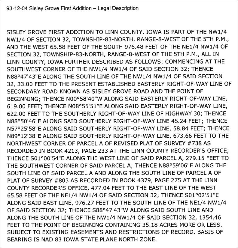
At the bottom of this article is an example of a legal description of land. The subject of this article is not the location of the land, but the way in which the parcel is described. The general public often jokes about how lawyers commonly make documents that are excessively wordy. It would appear that the surveying community likes to do the same.
Most land parcels are approximately rectangular. While the corner angles may not be exactly 90 degrees, the land is typically defined by four points that are connected via straight lines. With the advent of high-accuracy GPS, which is already used extensively in the surveying community, it would seem the simplest way to describe a location would be with four points of latitude and longitude. In instances where the parcel is an unusual shape, GPS makes it far easier to accurately describe than explaining it in words. Also, while we're in the mode of simplification, lets stick with degrees decimal for latitude and longitude. This degrees-minutes-seconds thing is a nuisance to type and requires more digits to get the same resolution as degrees decimal.
Last updated: February 5, 2012